Strasbourg neighbourhoods explained, with maps
The whole historic centre sits on one island you cross in twenty minutes. How Strasbourg's fifteen quarters fit together, and the four that matter.
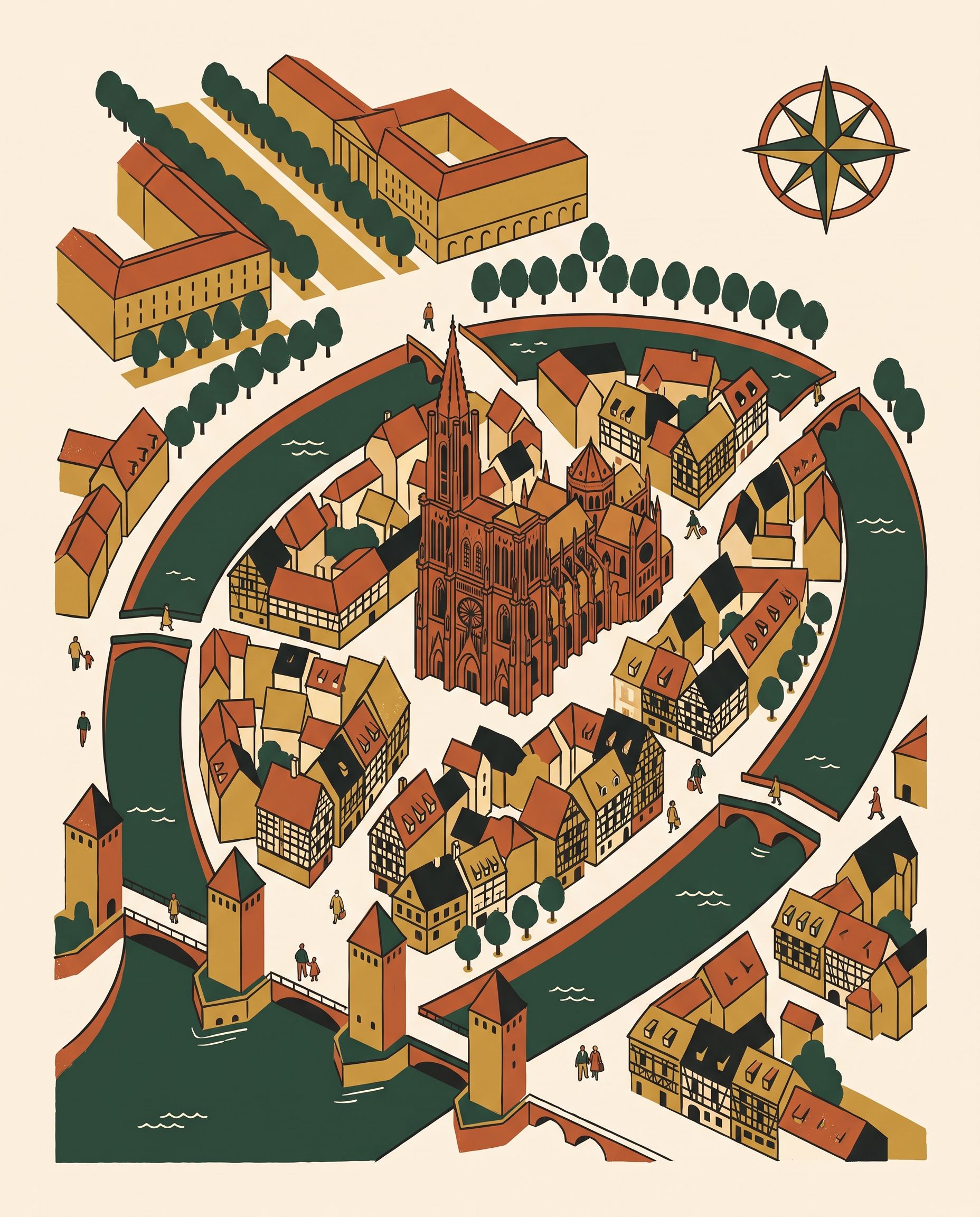
Strasbourg is an easy city, provided you have understood its geography. The whole historic centre sits on an island, and you cross that island on foot in twenty minutes.
Once that mental map is in place you will barely open your phone again. And if it is the whole city you want, quarter by quarter, the map of the fifteen official quarters is further down this page.
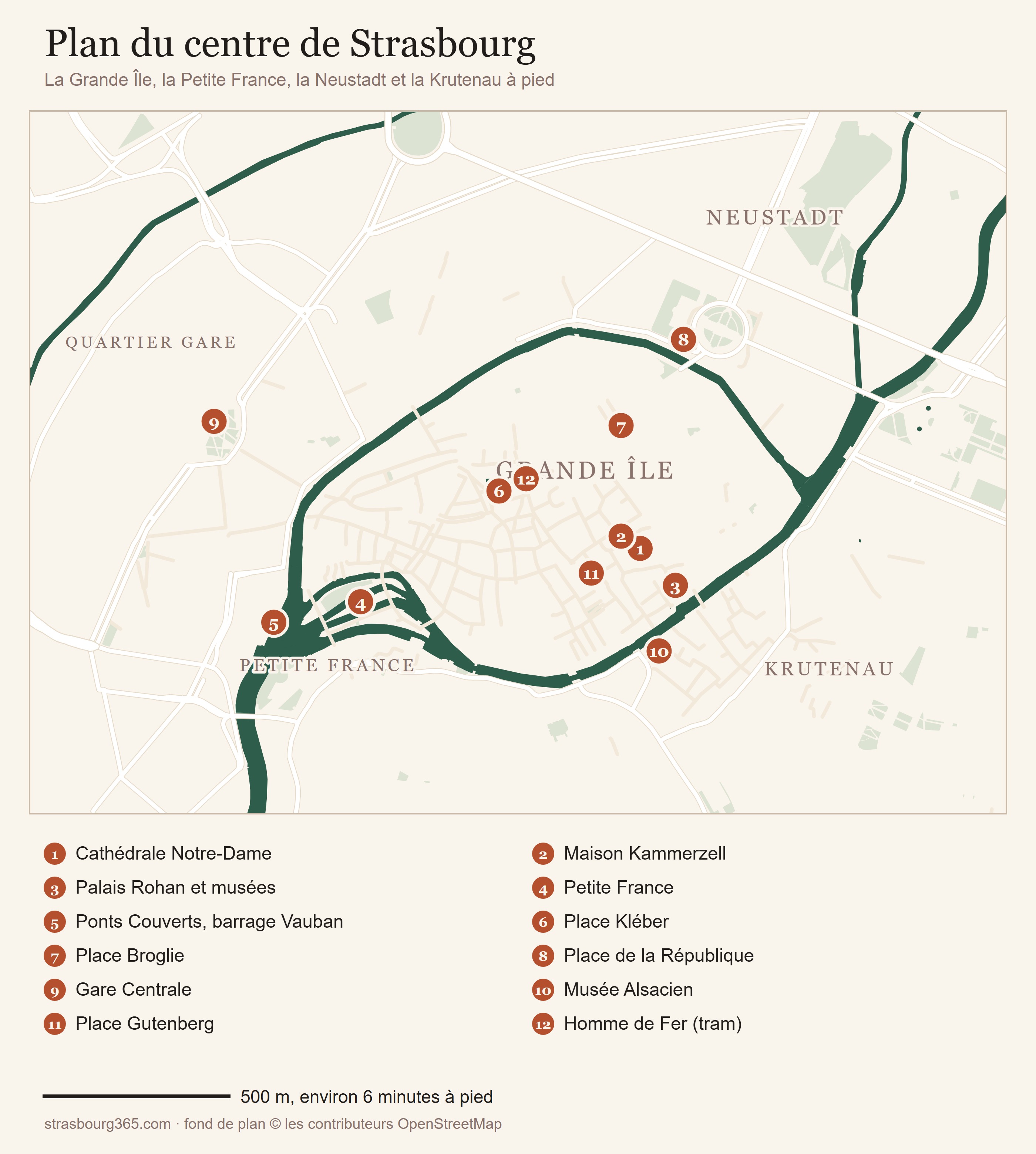
Tap the map to open it full size. It is built for a phone: the Grande Île with its twelve landmarks and a scale of walking times. On an iPhone, a long press on the image saves it to your photos. Base map © OpenStreetMap contributors.
Download the map of the centre (JPG, 650 KB) ↓
An island in the middle of the city
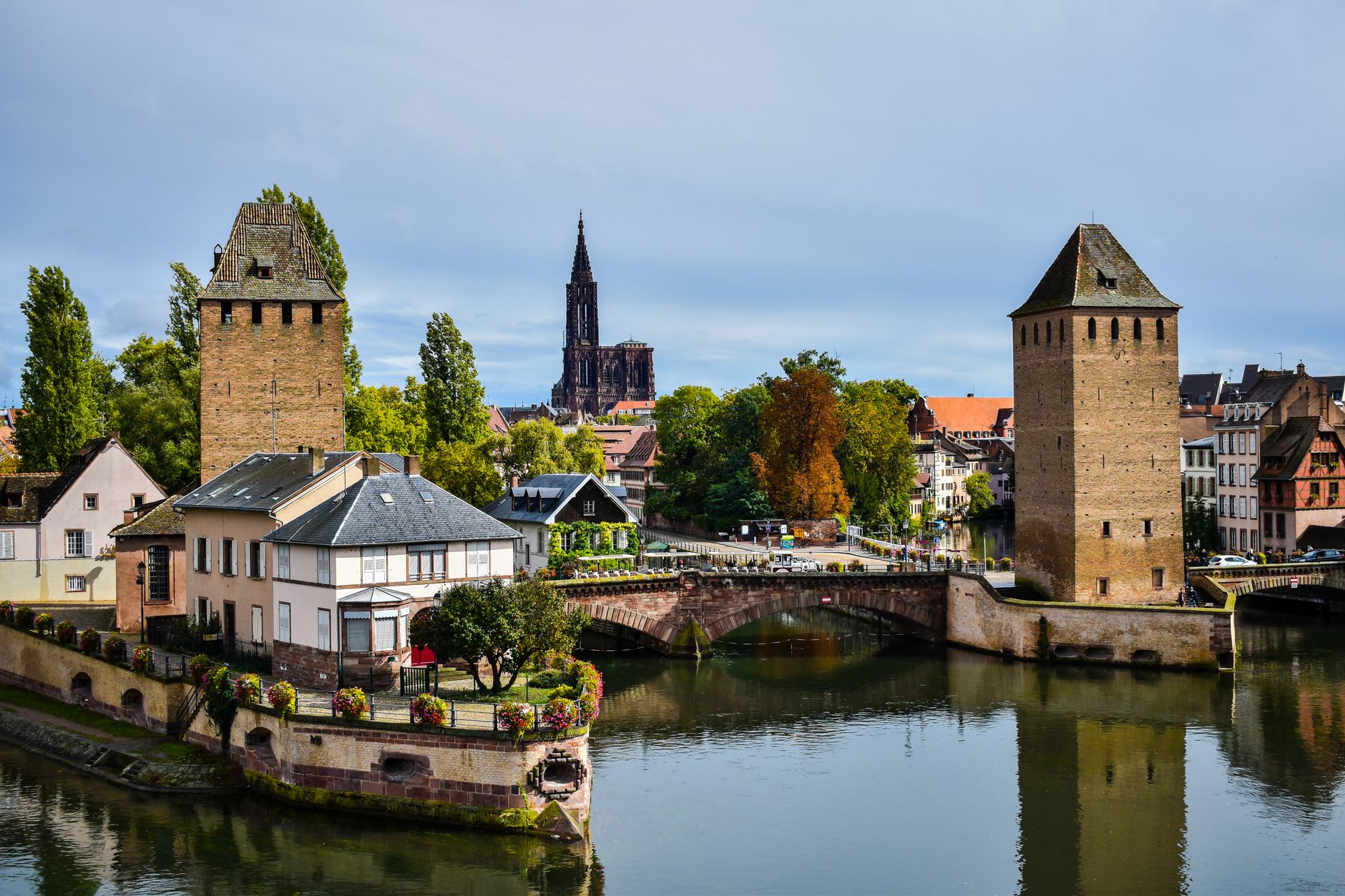
The centre of Strasbourg is the Grande Île, an oval of roughly 1,500 metres by 800 metres, ringed by the Ill, which splits into two arms and rejoins downstream.
The cathedral stands at its heart, La Petite France occupies the south western tip, and the squares Kléber, Gutenberg and Broglie punctuate the rest. Everything you have come to see is on this island or a few minutes off it.
The whole island has been a UNESCO World Heritage site since 1988, the first time a complete city centre was listed. In 2017 the listing was extended northwards to the Neustadt, the German city built at the end of the nineteenth century.
The map of Strasbourg quarter by quarter
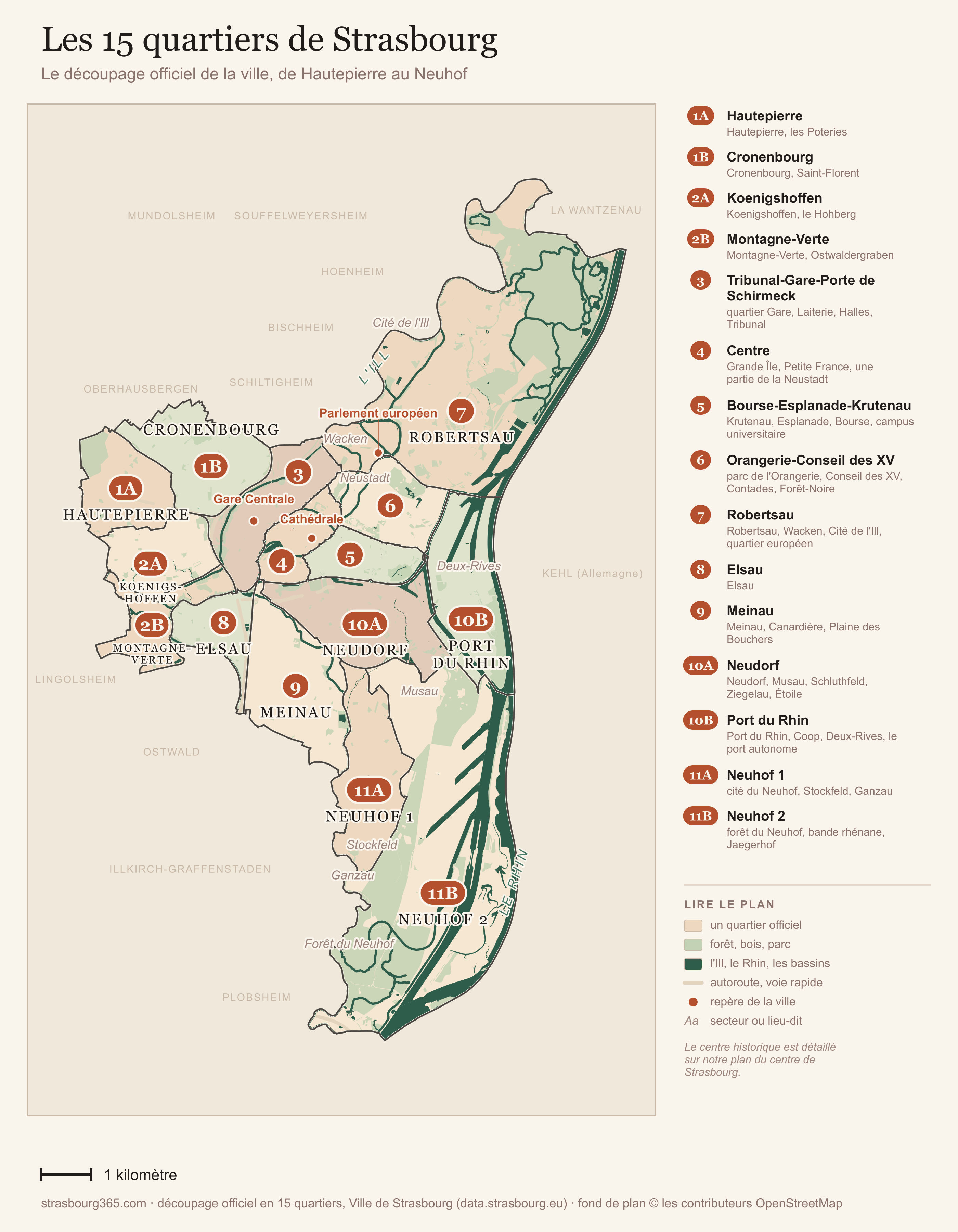
The fifteen official quarters from north west to south, with their sectors and localities. Tap to open full size. Official fifteen-quarter division, City of Strasbourg (data.strasbourg.eu). Base map © OpenStreetMap contributors.
Download the map of the quarters (JPG, 800 KB) ↓
This is the city's own division: fifteen quarters, numbered 1A to 11B, which share out the 78 km² (30 square miles) of the commune without leaving a metre uncovered. It is the division used by the district town halls and by estate agents.
Two numbers give you the scale. The four quarters of the centre and its ring (3, 4, 5 and 6) come to about ten square kilometres between them, an eighth of the city, and that is where practically your entire visit happens. At the other end, Robertsau and Neuhof 2, the two largest, make up nearly half the surface area of the commune, mostly forest.
The centre and its ring: the four quarters a visitor uses
4, Centre. The smallest of the fifteen, about 1.8 km², and the one where everything happens: the UNESCO-listed Grande Île, the cathedral, the squares Kléber, Gutenberg and Broglie, La Petite France, and part of the Neustadt as far as Place de la République.
3, Tribunal-Gare-Porte de Schirmeck. West and north west of the centre: the main station, the law courts, the Halles district and the Laiterie concert hall. This is the arrivals quarter, with practical hotels and brasseries of no particular charm. The Ponts Couverts and the Barrage Vauban fall on its side of the boundary by a few metres.
5, Bourse-Esplanade-Krutenau. South east of the Grande Île: the Krutenau and its bars, the Esplanade university campus, one of the densest parts of the city, and the Citadelle park. This is where the evenings happen.
6, Orangerie-Conseil des XV. To the north east: the well-heeled avenues of the Neustadt, the botanical garden, the Parc de l'Orangerie with its storks, and the Contades. The most comfortable residential quarter in Strasbourg, and the most pleasant to walk through.
The north and the Rhine
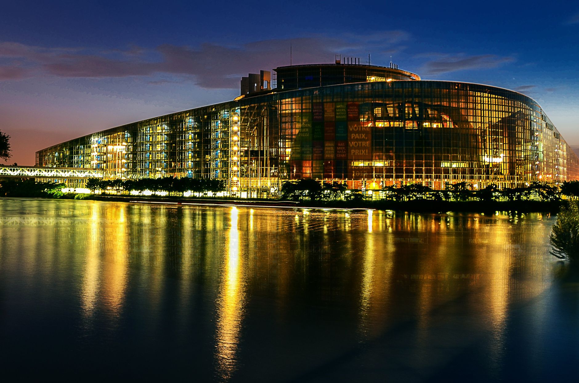
7, Robertsau. Nearly 18 km², the second largest, and three worlds in one: the old market gardening village with its forest, now a nature reserve, the Wacken with the exhibition centre and the congress hall, and the European quarter with the European Parliament, the Council of Europe and the European Court of Human Rights. Tram E, terminus Robertsau L'Escale.
10B, Port du Rhin. The city's Rhine frontage, facing Kehl: the port and its basins, the reclaimed Coop industrial site, and the new Deux-Rives quarter with its cross-border garden. Tram D runs through it and crosses the Rhine into Germany.
West and south west
1A, Hautepierre is the 1970s housing estate built in honeycomb blocks, with the Hautepierre hospital. Les Poteries, much newer, forms its western tip and is the terminus of tram D. 1B, Cronenbourg is a former village turned working-class quarter, and it is where the Kronenbourg beer takes its name from.
2A, Koenigshoffen runs along the Route des Romains, the old road to the Roman camp of Argentoratum, and this is where the Roman civilian town stood. 2B, Montagne-Verte is wedged between the Ill and the Bruche canal, very green and purely residential: nothing to visit, but one of the best cycle routes out of the city.
8, Elsau is the quietest of the fifteen, a peninsula of social housing between the river and the canal, in the middle of an urban renewal programme.
The south
10A, Neudorf is a former suburb that has become a city within the city, with its own shops and markets. To the north, the Étoile sector brings together the Rivétoile shopping centre and the Malraux media library on the peninsula. 9, Meinau holds the Stade de la Meinau, where Racing play, and the large Plaine des Bouchers business park.
11A, Neuhof 1 is the inhabited part of the Neuhof, and above all the Stockfeld, a garden city of 1910 that reads like a piece of social history. Terminus of tram C. 11B, Neuhof 2 is the largest quarter in Strasbourg, about 18 km², and almost empty: the Neuhof forest, the Rhine strip and the Rohrschollen island nature reserve. The city stops here, roughly ten kilometres (six miles) south of the cathedral.
For a stay of two or three days, four quarters are enough. Centre to see everything, Tribunal-Gare if you arrive by train, Bourse-Esplanade-Krutenau for the evenings, Orangerie-Conseil des XV to breathe. The rest of the list mostly serves to tell you where you are standing when you read an address.
Three landmarks so you never get lost
- The cathedral spire, 142 metres: visible from almost anywhere in the centre. When in doubt, look up.
- The Ill: cross a bridge and you are either leaving the island or joining it. Two bridges in a row and you have come out the other side.
- Homme de Fer: the tram interchange, three minutes' walk from Place Kléber. Every public transport route passes through it, as our guide to getting around explains.
The real walking times
They are all shorter than you imagine, and that is the main reason Strasbourg works so well as a weekend city.
| Route | On foot |
|---|---|
| Main station to the cathedral | about 15 minutes (1.2 km, 0.75 miles) |
| Cathedral to La Petite France | 10 minutes |
| Cathedral to the Ponts Couverts | 15 minutes |
| Cathedral to Place Broglie | 5 minutes |
| Cathedral to Place de la République, Neustadt | 12 minutes |
| Cathedral to the European Parliament | 35 minutes, or 15 minutes on tram E |
| La Petite France to the Krutenau, along the quays | 15 minutes |
Arriving, and where that puts you
By train, the geography is on your side: the station is inside the city, a quarter of an hour's walk from the cathedral, and everything is set out in getting to Strasbourg by train.
By air, the useful question is which airport, not which car park, and we answer it in flying to Strasbourg.
By car, the rule is simple: you do not drive on the Grande Île, which is largely pedestrian and expensive to park in. You leave the car in a park and ride at the edge of the city and come in by tram, which is the second half of do you need a car in Alsace.
The four commonest orientation mistakes
Confusing the squares. Kléber is the big shopping square to the north, Gutenberg the small cobbled one just south of the cathedral, Broglie the long esplanade in front of the opera house. They are five minutes apart, but always give a taxi driver the exact name.
Treating La Petite France as a separate village. It is a sector of the Grande Île, ten minutes from the cathedral, not an excursion. Plenty of visitors set aside half a day where an hour is enough, with a second visit at sunset.
Walking to the European Parliament without meaning to. That is 35 minutes along the northern quays with nothing much to look at. Line E does it in fifteen.
Skipping the Neustadt. It is the sector visitors overlook most often, even though it is UNESCO listed and begins twelve minutes from the cathedral. The imperial avenues are free of tourists even in December.
Do you still need a paper map?
For two days, no: the city is too compact to stay lost for long. Three precautions are enough.
Download the Strasbourg map offline in your navigation app, because the mobile network struggles in the narrow streets of the centre on busy days. Keep our two maps from this page in your photos, the centre one for walking and the quarters one for placing an address.
For the rest, our interactive maps bring together the main sights, the checked addresses and the park and ride sites. The tourist office on Place de la Cathédrale also hands out a perfectly usable free map.
The map in one sentence
An island in the middle, the cathedral at its centre, La Petite France to the south west, the Neustadt to the north, the station to the west, Europe to the north east, and fourteen quarters all around that make up the real city. For a visitor, everything else is done on foot.
Once the geography makes sense, the next question is what to do with it, and our guide to things to do in Strasbourg and to how many days you need both start from this island.
Sources: UNESCO (1988 listing of the Grande Île, 2017 Neustadt extension), official fifteen-quarter division of the City of Strasbourg (data.strasbourg.eu), OpenStreetMap base map, walking times checked on the ground by our editors.
Frequently asked questions
How many neighbourhoods does Strasbourg have?
Which area of Strasbourg should I stay in?
Is Strasbourg walkable?
What is the difference between the Grande Île and La Petite France?
Is the Neustadt worth seeing?
Margot Keller
A Strasbourgeoise by choice for fifteen years, Margot looks after the practical pages and the Christmas market file. Every year she walks the markets from opening day, to tell the honest mulled wine from the tourist trap.